Developed at the Wasatch Front Regional Council (WFRC). The application and its repository belong to WFRC; this page only summarizes my work. It is a modernized version of WFRC’s earlier Regional Commuter Flows map. I did not create the original; my contribution was rebuilding it on open-source tools.
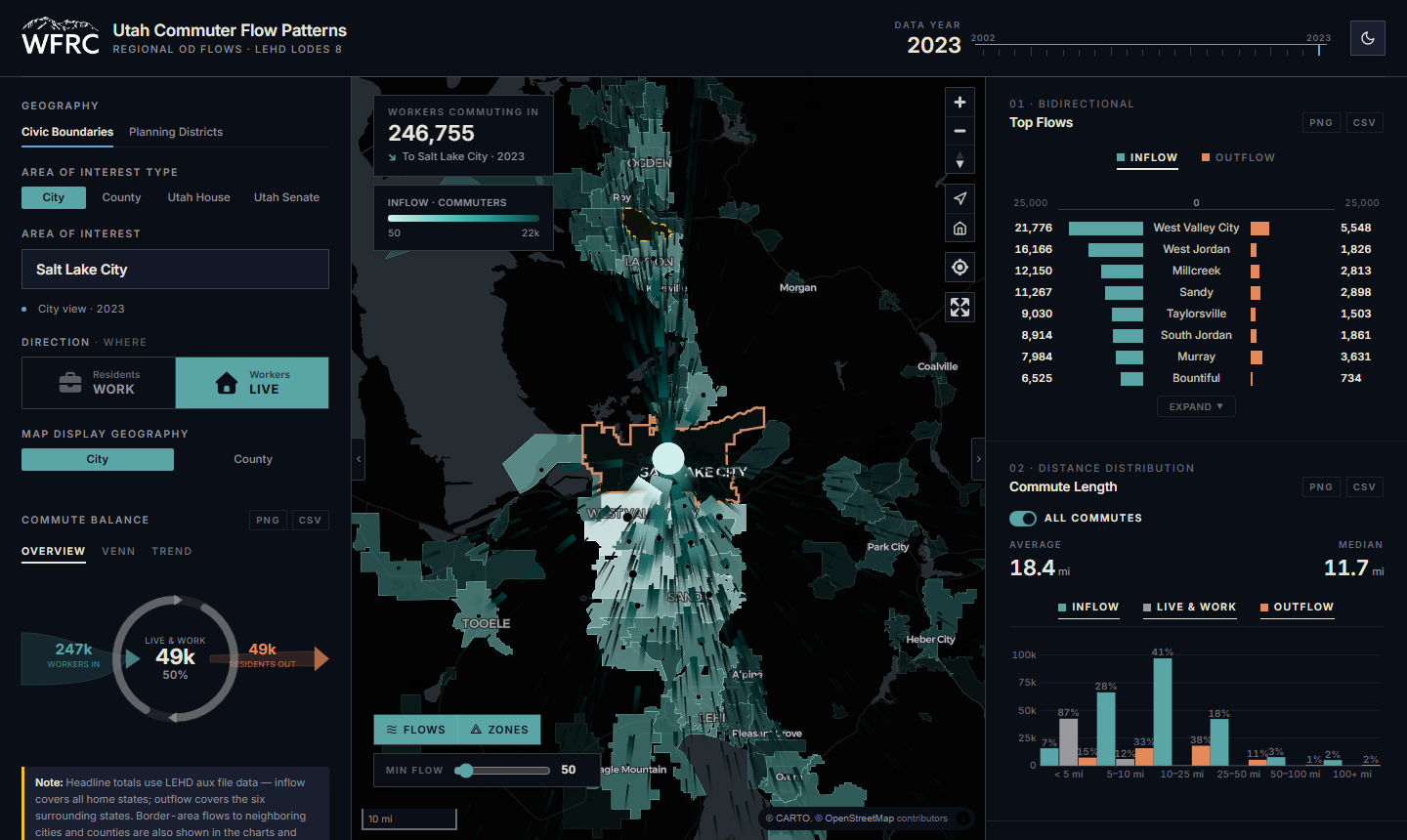
What it does
Pick a city, county, Utah House district or Utah Senate district and see where its residents work, or where its workers live, as arcs scaled by commuter volume.
- 22 years of LEHD LODES data (2002 to 2023), switchable from the header.
- Six linked chart panels: commute balance, a flow diagram, means of transportation and travel time to work (ACS 5-year), commute distance, and industry mix. Every chart exports to PNG or CSV.
- Light and dark themes that carry through the map, charts and controls.
What I worked on
- Rebuilding the application as a fully client-side web app: DuckDB-WASM queries pre-processed Parquet files directly in the browser, so there is no server, no API key and no ArcGIS dependency.
- The data processing that prepares the LODES and ACS tables for the app.
- The map, chart panels, theming and export features.
My role: developer. I authored all the commits in the repository.
See it
A companion tool, Commute Flow Explorer, covers free-placement analysis instead of fixed jurisdictions.